Dingley Dock
c. 1890
East Bay, Cedar Lake
.avif)
Dingley Dock
c. 1890
Images across the decades — from rail yard and industrial use to restored woodland, prairie, and shoreline.
.jpeg)
Oak Grove Hotel with proprietors Mr. and Mrs. Scott. The Jones Harrison Residence now occupies this site on the southwest corner of Cedar Lake.
.jpeg)
Kenwood Station, 21st and Upton.
.jpeg)
The Hotel Kenwood, built in 1896 at 21st and Sheridan and torn down in 1928. Home to railroad workers and immigrants.
.jpeg)
The old Burnham Bridge, looking southeast from Dingley Dock.
.jpeg)
Looking southeast to Brownie Lake with the old Cedar Lake Bridge (torn down in 1918) and Cedar Lake in the background.
.jpeg)
Dingley Dock on the east bay of Cedar Lake. Long ago, mounds of rubbish replaced the dock.
.jpeg)
Dingley’s Boathouse, with the old Burnham Bridge in background at right. Note land much more filled in.
.jpeg)
Looking west: Bryn Mawr Bluff, railroad tracks (where Cedar Lake Trail and prairie are now). Note Cedar Lake in background.
.jpeg)
Northeast edge of Cedar Lake and Cedar Lake Ice House. Sliver of land to right (now Hidden Beach) leads out to Dingley’s Boathouse.
.jpeg)
Looking east into downtown: tracks (where Cedar Lake Trail is now), houses on the Kenwood Bluff, and the Cedar Lake Ice House on the right.
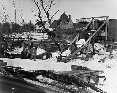
Men loading ice cut from Cedar Lake. Note Kenwood station and Hotel Kenwood in background.
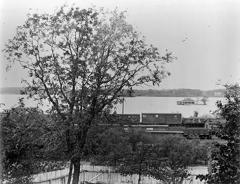
Looking west from Kenwood: Dingley’s boathouse (where Hidden Beach is now).
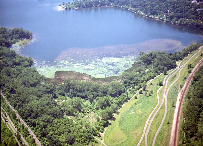
A view of Cedar Lake Park from the northeast. Prominent features include, from left to right, the Kenilworth Trail and rail, Upton Woods, the Hidden Beach peninsula, Cedar Lake, Cedar Point swimming beach, the spirals of the memorial Cedar Grove, the Cedar Lake Trail and restored prairie, and the main line of the Burlington Northern railroad. The railroad line was first established in 1858 on a causeway across the original north end of the lake.

With the Kenwood bluffs on the right and the Bryn Mawr bluffs on the left, the park is an oasis of tranquillity that allows hundreds of people to pursue a myriad of activities from sunrise to sundown. Downtown Minneapolis is just one mile east (right) on the Cedar Lake Trail.

The spirals in the Heart of the Park area. Note the memorial cedar trees located along each spiral. Each tree was individually purchased to honor a special person and to raise money for the park. Also visible in this photo are the summer solstice sunrise line and the runic calendar, as well as the secondary bike/walk cinder trails that describe a pyramid enclosing the center of the spirals.
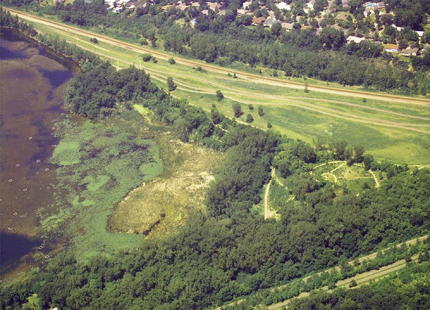
The northeast cattail marsh and the algae shallows around it. Note the white rings to the left. They are isolation chambers deployed as part of ongoing Eurasian milfoil research conducted since 1995 by the University of Minnesota Fisheries Department. To date, they have found a weevil that will eat milfoil, survive the winter, and reproduce. However, sunnies love to eat the weevils. Research continues.